Here at Hook we love the challenge of doing something we’ve never done before. So when Google’s ARCore team approached us with a project that required an unconventional animation technique, we jumped at the opportunity.
ARCore is Google’s platform for building augmented reality experiences. And this year Google upgraded ARCore with a powerful new feature, the Geospatial API, that lets developers create AR experiences tied to real world locations. This new tool was making its debut in the developer keynote at Google I/O and we were asked to help show off the wizardry behind the technology.
The Geospatial API relies upon a detailed 3D model of the world where buildings and bus shelters, statues and storefronts are all captured and mapped with striking precision. We wanted to show off the beauty and complexity of this digitized Earth with its billions upon billions of data points. But our normal animation software wasn’t made to handle billions of data points. We were going to need a bigger boat.
Enter the Unreal
Unreal Engine is a video game engine that was purpose-built for creating huge virtual worlds filled with highly-detailed scenes. This was perfect for our use case: creating a virtual version of San Francisco for our video’s opening sequence.
Test footage using Unreal Engine with low resolution city geometry
Trying to load a 3D model of the entire Earth and all of its cities would instantly crash even the beefiest computer. But using a custom data link from Google and an Unreal plugin called Cesium, we were able to download just the individual “tiles,” or sections of the city that our virtual camera could see.
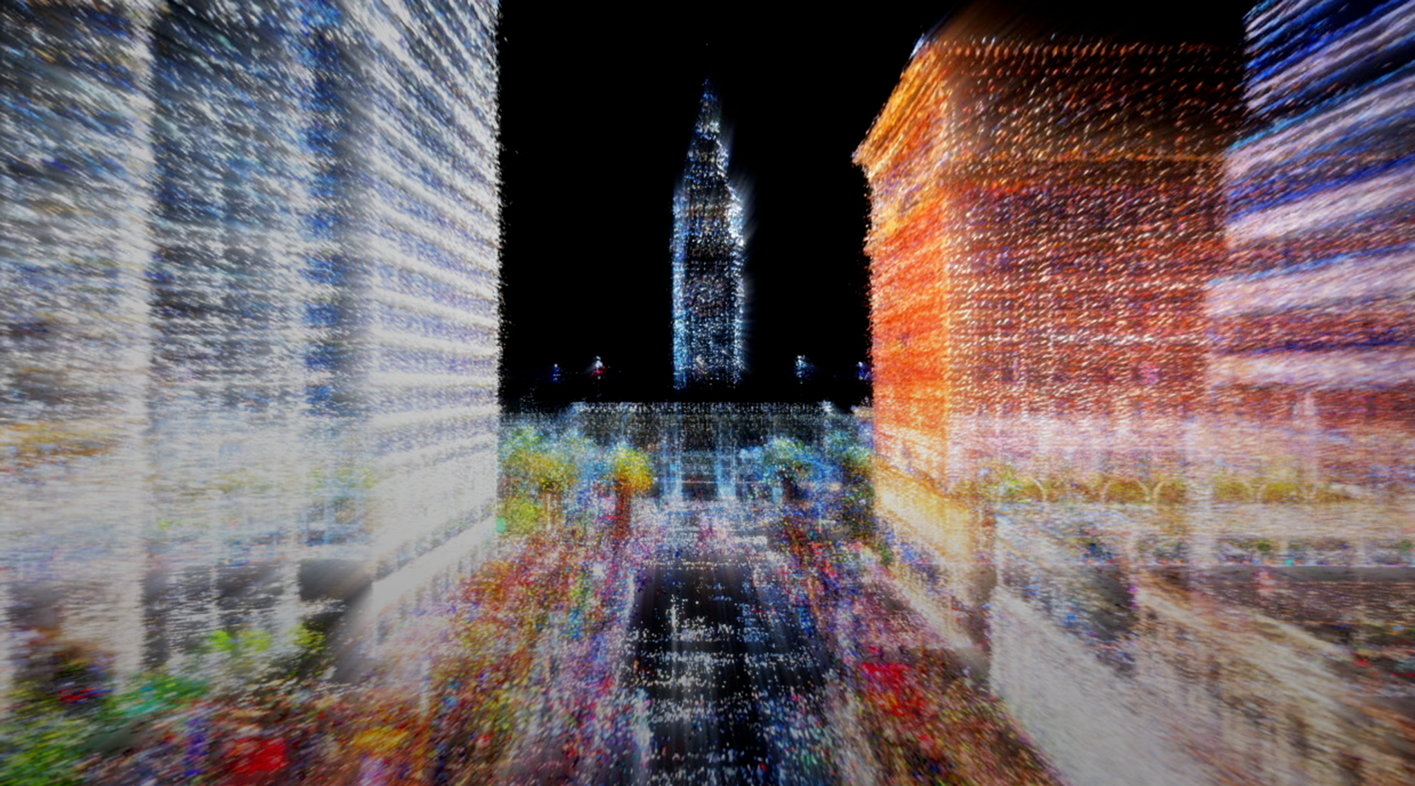
Left: “Video game” version of San Francisco | Right: Point cloud data of the same area
We combined this video game version of San Francisco with dense “point cloud” data from Google’s high-resolution 3D scan of the city. The final animated sequence vividly illustrates the layered, intricate model of the Earth behind the Geospatial API.
The final composite flythrough
The camera flythrough sequence we created in Unreal Engine was just one part of the final video, much of which was crafted using traditional 2D and 3D animation software as well as live action video footage. But by adding Unreal to our animation toolkit we were able to highlight the vast scale of Google’s Geospatial API and help our clients shine on the keynote stage.